Thursday, May 13, 2010

A liesurely day off....

Thursday, May 13

NK'MIP Campground

We enjoyed a restful day today. Managed to do the obligatory things like buying groceries and doing some laundry. Took my bike to "Double O Bikes" and left it for the day. Unfortunately the bike shop was 5 km from our campsite so I walked back to the campground and later walked back to pick it up. Just what I needed on a day off, a 10 km hike!!! The bike shop said that the "pothole" I hit (yes BC has them just like Ontario) a few days ago knocked the back wheel out of whack. It is now all "trued up" and ready to "climb".

The day off was good for us "physically" but maybe not "mentally" as the campsite has a perfect view of Anarchist's switch backs. Oh well, tomorrow we face it bright and early!!!

Sue's Daily distance = 25.38 km. Kevin's distance on the bike = 10.91 km. Kevin's hiking distance = 10 km. Time on the bikes (Sue's) = 2 hours 21 minutes (Kevin's) = 50 minutes. Average Speed (Kevin) = 12.99 km. Maximum Speed = 28.86 km. Daily High Temperature = 28 degrees.

Kevin = 1 1/2. Sue = 1/2.

Up one side and down the other....

Wednesday, May 12

Keremeos to Osoyoos

On the road by 7:55 am for 5 minutes! We decided to have breakfast in Keremeos (highly recommend The Ranch Restaurant) because of a very strong wind that blew all night and this morning. Keeping a stove lit would have been impossible! On the road for real at 8:45. A Wiarton like hill met us as we climbed out of Keremeos.

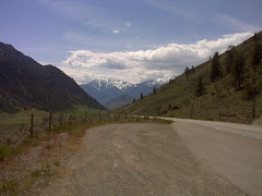
The story of the day was "up one side and down the other". A series of sharp hills plagued us all day making for some challenging climbs. Again we were following the Similkameen River with it's incredible views as we traveled through cattle country. Yesterday we waited for cattle to be herded across Hwy 3 by a horse and rider and a Border Collie. Today we saw bulls being herded by a cowboy. (I guess quads have not found there way into BC ranching yet). The River then turned south and since we did not bring our passports we had to leave it behind.

A 7 km climb to Richter Pass (elevation 682 metres which did not even warrant a sign so we could celebrate) was at grades that we could actually ride all-be-it with frequent stops. Then came the 8 km drop into the resort town of Osoyoos at the southern end of the Okanogan Valley where we are camped. The NK'MIP RV Park and Campground will be our home for 2 nights with its hotub and incredible views of Lake Osoyoos. No you did not read that wrong. We have decided to give our legs a rest for a day before we tackle the Anarchist Mountain climb, the climb that is etched in our brains from our trip through here in 2008. 27 kilometer climb with the first 10 to 14 km (depending on who you talk to) a series of switchbacks. I am also going to see if I can have my back wheel looked at by the local bike shop as I have a spoke that continues to come loose.

Met a guy today at the Osoyoos Information place who was riding a fold up bike that was pulling a trailer. The trailer is actually a suitcase that the bike fits into. It just looked like an old time hard sided suitcase. He was heading off into the US and in August for a bike tour in France.

Daily Distance = 65.78 km. Time on the bikes = 4 hours 49 minutes. Average Speed = 13.63 km. Maximum Speed = 57.73 km. Wildlife Sightings = rattlesnake (dead on the road), California quail

Wednesday, May 12, 2010

Following the Similkameen River....

Tuesday, May 11.

On the road by 8:00 am. Had a fantastic ride today. It is hard to believe that you can ride for almost 70 km downhill! Suspect we will pay for that! The Similkameen River was our companion for the whole day today. The views were stunning, from grazing land, to mountain views, to spectacular river views. British Columbia is truly magnificent. Sure can tell by my attitude that today was a beautiful ride. (And we never pushed our bikes once!!!). We arrived in Keremeos, the "fruit stand capital of Canada", by 3:00 pm and are camping at the Eagle RV Park and Campground next door to some sheep. Keremeos is in a desert. Yes we have a desert in Canada! If irrigation is not used nothing grows. Unfortunately we are in the off-season so all the fruit stands are closed. We are set up to ride to Osoyoos tomorrow with another mountain pass to cross. Oh well, two days in a row of easy riding probably was a little bit optimistic.

Update on the 4 person tandem bike. We heard today that they are on Hwy 3 at least one day ahead of us and gaining. We were told that yesterday when they went through Keremeos they were "hurting". They have to be in Calgary by May 20. Good luck! Their blog can be found at www.tandemtour.com (I think)!

Daily Distance = 74.51 km. Time on the bikes = 4 hours 18 minutes. Average Speed = 17.26 km. Maximum Speed = 56.19 km. Wildlife Sitings = deer, bald eagle, osprey.

Kevin = 1 Sue = 0

Tuesday, May 11, 2010

More down than up....

Monday , May 10.

Coldspring Campground to Princeton

We woke this morning to a brisk -1 C. I guess that is why the snow was still sitting beside our tent and the campground was not yet open for the year! Packed up and on the downhill road by 8:45. Five minutes later we came to Manning Park Lodge (We did not know that we were that close!) and stopped for.our 2nd breakfast. If nothing else by 10:00 we were well fueled. Today's ride was more downhill than up. 23 km of mostly downhill riding put us in a good frame of mind only to be challenged by some 8% and 9% grades for 2 to 3 km at a time. Crested Sunday Summit (elevation 1282 metres and therfore just a baby hill...a whole 59 metres less than yesterdays).and started into some nerve wracking downhill slopes at 7 to 9% with very poor shoulder and road conditions. By the time you had gone down 3 or 4 km your hands were numb from braking. We were forced to keep the speed around 30 km. We have decided to treat ourselves tonight and are staying at the Princeton Motel and are currently sitting in a laundromat as I am sure anyone in contact with us would say it was badly needed.

Update on the guy we came upon with the broken rack yesterday. My conclusion was probably right. We passed him (yes he had obviously passed us at some time) and he was carrying 3 clear garbage bags full of empty cans on his handle bars. I suspect he collects them for the deposit money!!!

Daily Distance = 72.31 km. Time on the bikes = 5 hours 7 minutes. Average Speed = 14.09 km. Maximum Speed = 52.92 km

Kevin = 1 Sue = 0

Monday, May 10, 2010

The day that did not want to end....

Sunday, May 9. Hope to Coldspring Campground (Manning Park)

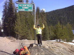
We were up early this morning and on the road by 7:15. Good thing we did. It was a hard day! I will rephrase that "it was an extremely hard day"! Training in Southwestern Ontario or on turbo trainers cannot prepare you for the climbs on Hwy 3. The first 18 km to Sunshine Valley was uphill. And I mean no let up. 6 kilometres of this was at a 7% grade. Then we had a downhill where we were a little chilly and then the climbing started again. At times we walked and at other times our "Granny Gear" was our best friend. Through BC "Granny" will get a workout. By about 47 km we were ready for the day to end. If a suitable "gorilla campsite" (wilderness) had been found we would have stopped. We were forced to continue, however, as the shoulders were either rock face or cliffs. With some riding and some "pushing of the bikes" we made it to Allison Pass Summit (elevation of 1341 metres). After a celebration and picture taking, we coasted 7 km to Coldspring Campground in Manning Park. We are camped in a facility not yet open. There is snow beside our tent.

Met a biker today about 10 km outside of Hope who had his back rack break and he was trying to temporarily put it back on so he could continue. His destination was unclear to us. Seemed like he was just wandering. Another biker passed us hoping he would have a flat so that he would have an excuse to stop. Tough day!!!

Daily Distance = 67.65 km. Time on the bike (or pushing it) = 6 hours 58 minutes. Actual Time = 10 hours 45 minutes. Average Speed = 10.28 km. Maximum Speed = 52.42 km.

Kevin = 1 Sue = 0

Saturday, May 8, 2010

First of many plan changes....

Saturday, May 8

We were packed up and on the road by 8:45. Hwy 7 again provided beautiful scenery and relatively flat terrain. However, the 4 months of sunshine, temperatures around 20 degrees, and a tailwind had a "hiccup". For much of the day we fought a headwind which at times made for some slow progress despite the flat terrain. Guess my "wish" was a little bit optimistic!!! Then came the first, but probably not the last, change of plans. The preferred destination was Sunshine Valley but with a few phone calls made from the tourist info place in Hope we found accomadation was non existant so we decided that the prudent thing to do was have a short day today in preparation for the mountains tomorrow. The good news is we only have 64 km to ride. The bad news is it is a very challenging ride to the first mountain pass in Manning Park to a campground where the services are not open until May 15. Knew there were going to be days like this!!! We are camping on the Coquihalla River (yes Sue is happy with the sound of the river flowing past) at the Coquihalla Campground in Hope.
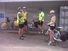
It is always interesting the people you meet. Today we crossed paths with a tandem bike with 4 young men on it who yelled at us that they were on their way to Halifax. They had a trailer/truck supporting them. We also met an older gentleman in Hope who had cycled in France and Italy...and truly seemed to be envious of our trip.

Plan is to be up and on the road "early" or at least much earlier than the last 2 mornings.

Daily distance = a paltry 44.04 km. On the bikes = 3 hours 10 minutes. Average Speed = 13.85 km. Maximum Speed = 42.90 km. Slowest Speed probably about 7 km.

Kevin = 1 Sue = 0

Friday, May 7, 2010

It has actually begun....

Friday, May 7

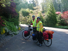
The trip has begun for real. We were on the road by 8:35 am. after another official picture taking ceremony at our friends house in Maple Ridge. We would again like to thank Nancy, Gashaw, and Michael for "putting up with us" for 4 nights as we turned your house upside down. Your friendship and support has helped us to begin our adventure. Thanks so much.
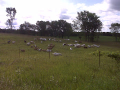
Today was quite a nice ride along the Lougheed Hwy through flat agricultural lands bordering the Fraser River. We had a 3 km climb before Agassiz and then an exhilerating fast downhill until the road flattened out again. We are camping at the Pathfinder Motel, RV, and Campground in Agassiz with a pair of Holsteins next door quietly watching us. A 5 km ride to the grocery store and back means we will have a nice chicken stir fry with salad for dinner. Life really is "tough"!!! Our goal tomorrow is to get to the Sunshine Valley area just at the edge of Manning Provincial Park.

Daily Distance = 76.98 km. On the Bikes 4 hours 50 minutes. Average speed = 16.05 km. Maximum Speed= 64.36 km.

Kevin =1 Sue =0

Thursday, May 6, 2010

Ready to go....

Thursday, May 6

Today was a day to "truly" get ready to start the ride. We took a 2 1/2 hour training ride around the Maple Ridge area once again. This was the day to make sure that the bikes were ready and to do some laundry. Who knows when laundry facilities will be available again!! Packing is in progress as I write this. Goals have been set for the first 3 days of our ride and believe it or not some of my nervousness seems to have been reduced. Just making the decision to begin has helped. We are actually going to do this. 2 1/2 years of planning and tomorrow we actually begin. St. Johns here we come....

Kevin =1. Sue =0

Wednesday, May 5, 2010

More training and last minute preparations....

Wednesday, May 5

Not much excitement today. Took 2 hours to ride 8.6 km. No it was not because of the hills!! We were on a last minute shopping trip. Grocery store, post office, bank, and a stop for lunch. Great training!! Rode back towards Vancouver and returned to Maple Ridge on a very busy Lougheed Hwy. (Collin I hit 46 kmh today). Think we will set out "for real" on the "adventure" on Friday morning.

Kevin = 1 Sue =0

Tuesday, May 4, 2010

Back to training....

Tuesday, May 4

In case anyone is confused, we are just following our plan. A few days in Maple Ridge for "training" before the real journey begins. We decided to ride from Maple Ridge to Mission on the Dewdney Trunk Road and return by way of the Lougheed Highway or Hwy. # 7. First 15 km seemed to take forever. Then we figured out why. We had been gradually climbing. 10 km downhill on curvy roads in about 10 minutes, pretty much riding the brakes the entire way. Never knew what might be around the next curve. Quite fun actually. Looking forward to those downhills in the mountains. But you know the climbs are still a concern!!! Tomorrow another training ride.

Kevin =1 Sue =0