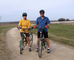
Thursday, September 9, 2010

Wind, Hills, Rain...Just What We Expected In Newfoundland....

Thursday, September 9

Bellevue Beach to Holyrood

After a nice 'relaxing' night in our 'cozy' log cabin we were on the road by 7:30. Climbing out of Bellevue Beach was quite a challenge but we were pleasantly surprised that it was only 2 km not the 5 to 7 that the map showed. Once again we are amazed at the inaccuracies of Newfoundland's Provincial Roadmaps!

Today Newfoundland threw 'everything she had and then some' at us. A strong headwind, lots of hills, and a steady rain made our day another 'challenging one'. I do not think that we had recovered from our tough ride 2 days ago. As Sue said part way through the day, "my leg muscles just will not loosen up". I call it 'dead legs'!

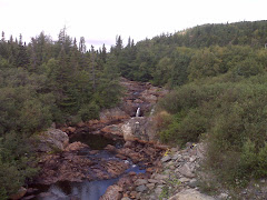
The scenery continued to be spectacular as we climbed up through the valleys. No wonder this province is affectionately referred to as 'The Rock'. The east side is just as spectacular as the west and definitely more hilly. Again we passed through a wind swept area where the small trees were all leaning in one direction. Easy to see what direction the prevailing winds are.

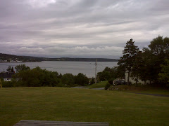
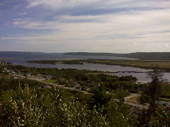
We are staying at the Beach View Motel in Holyrood. Again we have ventured off the highway and come 'down' to the ocean. The motel is situated high on a hill with one of the best views that we have had of houses built on the side of rock above the water. It is just what we had pictured that Newfoundland towns would look like.

Daily Distance = 72.74 km. Time on the bikes = 5 hours. Average Speed = 14.53 km. Maximum Speed = 44.93 km. Wildlife Sightings = Black Backed Gull, Kingfisher, Blue Jay, Moose. (Yes we finally saw a moose on The Rock)!!!

Kevin = 3, Sue = 1.75 (but it had nothing to do with her bike)!

Wednesday, September 8, 2010

What a Difference a Day Makes....

Wednesday, September 8

Clarenville to Bellevue Beach

On the road at 8:10 and climbing back up to the highway. One thing we have realized on 'The Rock' is that if you leave the highway you can count on doing some climbing. Newfoundland's population is coastal and the Trans Canada is not.

Today more than made up for yesterday. The wind was still strong but primarily in our backs so even though there was still lots of climbing, it did not seem nearly as difficult. Our biggest problem today was a result of yesterday...'tight leg muscles'! It is hard to believe that after all of the cycling that we have done we still have 'fatigued' leg muscles!
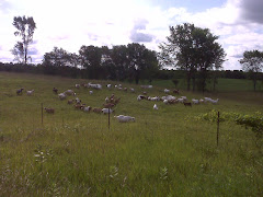
As we rode along we came upon the community of Arnold's Cove. We could 'smell' it before we saw it. Arnold's Cove has a 'huge' oil refinery...thus the smell! I suspect it has something to do with Newfoundland's new found offshore oil. As we climbed away from the refinery we passed through an area almost 'void' of vegetation. Either this area had a 'nuclear attack' at some time or it must be one 'windswept' chunk of rock. I suspect it is the latter since we probably would have heard about the 'nuclear theory'!!!

We decided to leave the Trans Canada and head out to a coastal community for our accommodation tonight. Remember that thing about leaving the highway and hills, well we met the 'steepest' hill we have faced in Newfoundland. We are staying in a 'log cabin' on the ocean at the Fiddler's Green Resort. It is a really nice 2 bedroom unit with a full kitchen. Too bad all we have to cook are 'Sidekicks', our old standby.

Daily Distance = 82.57 km. Time on the bikes= 5 hours 4 minutes. Average Speed = 16.29 km. Maximum Speed = 53.94 km. Wildlife Sightings = Osprey, Bald eagle, Cormorants, Black backed gull, Red Squirrel, Mourning Cloak Butterfly.

Kevin = 3, Sue = 0.

Tuesday, September 7, 2010

Working HARD For Every Pedal Stroke....

Tuesday, September 7

Glovertown to Clarenville

One of the drawbacks of staying at B+B's is that you cannot control your departure time. So today we left Glovertown 'well fuelled' but on the road late! It was 9:20 by the time we had climbed out to the highway.

Today was 'one tough day'. Between the 'many' climbs and the 'terrifically strong' headwind we worked hard for every peddle stroke!!! The headwind gusted so strong at times that it would almost bring you to a stop. One gust moved me so one of my front bags actually glanced off of the guardrail along the side of the highway! We have not worked this hard nor have we been this tired since we faced some terrific winds back in Saskatchewan.

As we rode through Terra Nova National Park we were overtaken by 2 Cross Canada cyclists who had left Vancouver July 6. They were probably in their 60's and were riding 'supported' on really 'nice' road bikes.

We are staying in the Restland Motel in Clarenville. It is not a bad motel with a fairly large room, lots big enough for our 2 bicycles and all of our gear.

Daily Distance = a gruelling 95.52 km. Time on the bikes = 6 hours 32 minutes (and my butt feels like it). Average speed 14.61 km. Maximum speed 56.19 km. Wildlife sightings = red squirrel, bald eagle, osprey, junco, black backed gull.

Kevin = 3, Sue = 0.

P.S. The huge 'bank' of black clouds that chased us all afternoon has finally arrived and it is now raining heavily.

Monday, September 6, 2010

Four Months On The Road....

Monday, September 6

Gander to Glovertown

On the road by 7:35 with the sun shining and the wind only 'slightly' less strong. It was nice to be on the road again as we enjoyed views of Gander Lake, Square Pond, and Butts Pond. (Nice names). We encountered many long climbs today one of which was over 5 km. Combined with the wind that blew steady at 30 km and gusted to over 40 km, today's ride had some challenging moments.

As we rode along today we came upon 'Joey's Lookout', a place with a panoramic view of the town of Gambo and Freshwater Bay. The Gambo area is the birthplace of 'Joey Smallwood' Newfoundland's 'Father of Confederation' and it's longtime Premiere. Gambo was an important lumber town from the 1860's until the 1960's. Massive forest fires brought that to an end.

We are staying in the Cuddle - Inn B+B in the town of Glovertown. It is right on the ocean. We were unaware, however, that the town was 5 km off of the highway, and worse yet, all downhill. So tomorrow morning we will have to climb back up to the highway and I mean CLIMB! The other thing that we are finding frustrating is the inaccuracy of the provincial road map. Today was to be 73 km and it was only 67 km. Now I know everyone is thinking "but it was in your favour". Problem is we suspect that will be tacked onto tomorrows distance instead. It makes me wonder if like everything else in Canada, Newfoundland 'subs out' its map making to a foreign company who probably uses 'Google Maps' to get its information. Now that is a real confidence builder.

Daily Distance = 67.18 km. Time on the bikes = 4 hours 6 minutes. Average Speed = 16.32 km. Maximum Speed = 59.90 km. Wildlife Sightings = Red Admiral Butterfly, Junco.

Kevin = 3, Sue = 0.

P.S. Today represented the end of our 4th month on the road!!!

Sunday, September 5, 2010

A Good Decision....

Sunday, September 5

Gander

Maybe one of the better decisions we have made on this adventure might well have been taking the day off today. The winds that were predicted most definitely materialized. Steady winds out of the south at 40 km and gusting to over 50 km would have been less than a pleasant experience. 75 km in 'Granny' would have been a bit much!

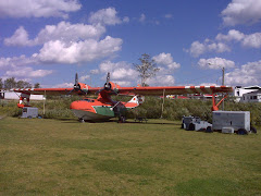
So again we became tourists. We decided to visit the North Atlantic Aviation Museum. Outside the museum there are 4 airplanes. A 'Lockhead Hudson' (1 of only 8 left in the world), one of the principle aircraft used by the RCAF Ferry service during WWII ,a 'water bomber' used by Newfoundland Forestry Service to fight forest fires, a Beech 18-S (an old RCAF fighter plane), and a CF-101 Voodoo (an old fighter jet). Inside you can get into the cockpit of a DC-3 and examine 50 cal. Machine guns up close. It is a worthwhile visit and the neat part is we had no idea it existed!

Gander...an update. The 'Newfoundland Airport' was built in 1938 to serve as a refuelling station for transatlantic aviation. It was one of the main airfields used by the Royal Air Force Ferry Command (shuttling pilots to England after being trained in North America) and became a USAAF base during WWII. At its peak 10,000 Americans and 5,000 RCAF and RAF were stationed here. No wonder we can see so many ex-military housing units in Gander. This town was military! The RCAF still have a base here. Gander became a commercial airstrip after the war but in recent years has become less important with airplane's ability to not need refuelling. Gander still provides technical help to the commercial and military aircraft of many countries.

Friendly Newfoundlanders...We Think....

Saturday, September 4

Bishop's Falls to Gander

On the road by 7:50 with raingear at the ready. After 2 days of easy riding Newfoundland showed us some hills again. Combined with a strong 'headwind' of 30 km this made for some 'tough slogging'. We have been paying attention to the track of Hurricane Earl to see what effects, if any, it will have on us. It appears that we may miss the rain but the prediction is for some 'nasty' winds up to 60 km from the south...guess what direction we are now heading? So tomorrow we are staying put. It sounds like the west side is even worse off, particularly the Port Aux Basque and Wreckhouse areas.

As we were having lunch on the side of the road today a fellow touring cyclist stopped to chat. He is from Waterloo and is a 4th year philosophy major (real future there) at Memorial University. He is riding from Halifax to St. John's and has to move apartments and be in class on September 9. He will make it as yesterday he cycled a 'ridiculous' 200 km.

As we have cycled through Newfoundland we have realized that we have been 'honked' at more here than anywhere else in Canada. We are unsure if it is because they are trying to be friendly or if Newfoundlanders drive with one hand on their horns! Another thing we have experienced is that grocery store clerks use the term 'my love'. And trust me most of them would not be 'my love'!!!

We are camped out in the Comfort Inn in Gander. As we walked to the grocery store we realized just what an impact the American Air Force base must have had on this town. Large areas of old military housing is quite evident. We do not know what the economy here is based upon now after the Americans pulled out.

Daily Distance = 76.83 tough km. Time on the bikes = 5 hours. Average Speed = 15.37 km. Maximum Speed = 44.10 km. Wildlife Sightings = Still no moose..

Kevin = 3, Sue = 0.

Friday, September 3, 2010

8000 KM AND COUNTING....

Friday, September 3

Badger to Bishop's Falls

On the road by 8:40 to a beautiful sunny sky. We were in no hurry as we had decided upon a short ride today. We had a 'wind assisted' ride to Grand Falls - Windsor this morning. We followed alongside the Exploits River which is a very large river that at times even had islands in it. As we passed Grand Falls - Windsor we decided to pick up some groceries and have an early lunch. While we were loading our groceries onto our bicycles we were approached by two different men enquiring about our ride. Newfoundlanders sure are friendly. The one shook my hand and 'officially' welcomed me to 'his' province. No it was not Danny Williams!!!

Grand Falls - Windsor is another town hurt by the closure of an Abitibi Bouwater pulp and paper plant about 2 years ago. It sounds, however, like this town has survived okay so far.

After lunch we had another leisurely ride to our destination, the Exploit's River Motel. It is located just East of Bishop's Falls. It is quite a nice little motel located on top of a hill overlooking the Exploits River Valley and the TCH. We are even able to do our laundry. After the last 2 nights, this is 'luxurious'!!!

Daily Distance = 54.30 km. Time on the bikes = 2 hours 52 minutes. Average Speed = 18.85 km. Maximum Speed = 53.94 km. Wildlife Sightings = Black Duck = Mourning Cloak butterfly.

P.S. Did I mention that we passed the 8000 km mark for our adventure???

P.S.S. We are sitting in front of the motel enjoying a Black Horse Lager. Life is good!

Thursday, September 2, 2010

"Rollin On Down The Highway"....

Thursday, September 2

Sheppardville to Badger

On the road by 7:25 this morning to a 'dark' sky and a 'bad' forecast. Newfoundland showed us more of its 'flatness' today. The riding was fairly easy as we followed the Trans Canada through the 'middle of nowhere'. Every once in a while a lake would appear and we even caught glimpses of the Ocean. As far as services go this area is void of anything.

Campgrounds in Newfoundland are 'few and far between'. The other thing we have realized is that nobody comes to Newfoundland with a tent. All the parks are set up for RV's. The campground we saw today had some really nice looking sites on the water but the 'drive by' sites were in a gravel parking lot right on the 'bloody' highway. Yipee!!!

And I have not mentioned the heavy rains that we rode through this afternoon and even heavier rains since we arrived at our destination. We are in the Badger Drive Motel. It is another 'crummy' little place but much more reasonably priced than last nights. It has recently been painted so all the switch and receptacle covers have not been put back on. You would not want to do that before you rented the room!!! There also must be a shortage of light bulbs in this province as this one, like last nights, has 50% of them missing!!! But the roof does not leak and we are dry!!!

Daily Distance = 88.59 km. Time on the bikes = 4 hours 49 minutes. Average Speed = 18.37 km. Maximum Speed = 58.26 km. Wildlife Sightings = Pied-billed Grebe, Black Duck, Gray Jay (it tried to steal Sue's bagel out of her hand).

Kevin = 3, Sue = 0.

Wednesday, September 1, 2010

Riding Off Into The Wild Blue Yonder....

Wednesday, September 1

Deer Lake to Baie Verte Junction (Sheppardville)

On the road by 8:00 after a nice breakfast at our B+B. It was 'cool' for the first part of the ride as the temperature was below 10 degrees and it was cloudy. Soon the sun broke through and we enjoyed a 'beautiful sun filled sky'.

We 'finally' turned east today and we also 'finally' found a flat part of Newfoundland. Today's ride reminded us of both Northern Ontario and New Brunswick. The highway 'across the top' is cut through nothing but bush and has very little habitation except for a few private trailer parks. Our # 1 companion was logging trucks arguably as many as we saw in the Fort Francis area. They would be taking their loads to the pulp plant in Deer Lake. We are told that production levels are pretty low so one wonders if it will remain open or if it will close like the one in Stephenville did a couple of years ago.

As we were riding this morning we were overtaken by another Cross Canada Cyclist. We are beginning to get a 'complex' seeing the back wheel of so many cyclists as they 'blow past' us! He has been on a real mission. He left Vancouver on July 12 and has a flight out of St. Johns on September 9. Today he was looking at getting to Grand Falls - Windsor about a 260 km ride. Makes our 100 km seem pretty minuscule!!!

We are staying in the Junction Inn tonight. We had very little choice as the campground that was supposed to exist no longer does. It now says "PRIVATE PROPERTY - KEEP OUT". Okay, we can take a hint! Our motel is not the nicest that we have stayed in but 'beggars cannot be choosers' and it is 'semi' clean.

Daily Distance = 99.16 km. Time on the bikes = 5 hours 29 minutes. Average Speed = 18.07 km. Maximum Speed = 51.93 km. Wildlife Sightings = Blue Jay, Grey Jay, Moose Tracks

Kevin = 3, Sue = 0.

Savouring Our Time On The Rock....

Tuesday, August 31

Corner Brook to Deer Lake

On the road by 8:00 with 'raingear' at the ready. The raingear was needed within about 30 minutes as the 'black clouds' produced what we thought they might. No it was not snow but it was not warm either.

Aided by a tail wind today was quite an easy ride. (At least after we climbed back up to the Trans Canada from our Motel). A 6 km descent to the banks of the Humber River was a pleasant surprise. Through the Marble Mountain Resort area, Newfoundland's premiere skiing area, (and maybe the only one) we rode through the rain. We cycled high above Deer Lake (the actual lake) and were rewarded with spectacular views of the rock faced hills, large houses, and the lake itself. A really nice ride was made even better when the rain stopped and dryed us out.

Yesterday afternoon while buying groceries, we met 2 more Cross Canada cyclists. One left Tofino on Vancouver Island June 12. He is from Mississauga and is looking forward to the completion of his journey. The other guy was from Montreal. He is looking at a rather unique way of returning home. He is thinking of going to Argentia and returning to North Sydney. He will then ride to PEI and take a ferry to the Magdellan Islands. He will then take another ferry to the Gaspe. Then he lost me. He may have told me the route after that but his English was only slightly better than my French so we were not understanding each other very well. Today we met a Harley Davidson rider from Alabama. He owns a Harley Dealership and has been on the road for quite some time. Understanding him at times was almost as difficult as the Montreal cyclist!

We are staying at the 'Lucas House B+B' in Deer Lake. We have the run of the house. It is owned by a British gentleman who was an urban planner in the 'old country' up until 4 years ago. This is the day for accents and none of them are Newfoundland ones! He jokingly said that there is not a lot of calling for urban planners in Newfoundland. He instead owns 2 B+B's.

Daily Distance = 57.17 km. Time on the bikes = 3 hours 17 minutes. Average Speed = 17.36 km. Maximum Speed = 62.25 km. Wildlife Sightings = Black Backed Gulls, Moose tracks.

Kevin = 3, Sue = 0.