Monday, May 31, 2010

Hello Saskatchewan...Goodbye Alberta....

Monday, May 31

Medicine Hat to Maple Creek

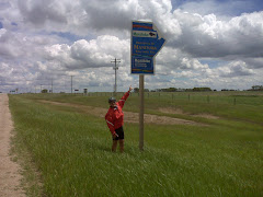
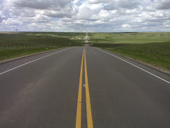
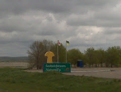
Two important things happened today. We had to say goodbye to our companion since the beginning of our trip, Hwy #3, and we said hello to Saskatchewan!

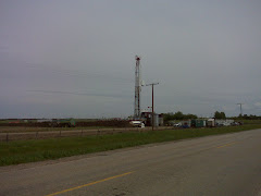
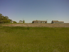
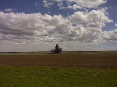
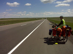
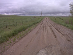
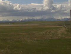
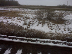
On the road by 8:10 and onto the Trans Canada Hwy for the first time. Riding in Medicine Hat was quite easy (unlike Lethbridge) except at kilometre 13 we were just hitting the eastern edge. It is one drawn out city considering it only has a population of 56000. It was a quick pack of the campsite this morning or I probably should say, a quick move to the picnic shelter. It started to lightly rain at 6:00 am. For the first couple of hours we rode in a drizzle so we were being sprayed by trucks. We had the perfect tail wind today so riding, despite the cold and wet, was great! In Walsh (Alberta - Saskatchewan border) while having lunch we met 3 ladies who were returning to Lethbridge from Saskatoon after competing in a half marathon yesterday. One of them rode across Canada with the Tour de Canada bike tour 4 summers ago. Small world! And how could I not mention the incredible Saskatoon Berry Pie I had for lunch. Quite good! We rode through Alberta's and Saskatchewan's Badlands today. Thousands of acres of ranch land up into the hills, yet we really did not see many cattle. (One wonders if it had something to do with the 1000's of acres we could not see)?

Southern Alberta.... What can be said about a province that really did not want to let us cross it. Unfortunately our memories will always be dominated by the lousy weather. But there were positives. It is relatively flat. The roads were even better than BC for riding bicycles as the paved shoulders were even wider. The 'Truckers' were incredible. If they could possibly give us room they did. The people that we met, just like in BC, were really good to us. The scenery, though nothing like BC, had its moments. Cropland, irrigation systems, ranch land, rivers, and how could we forget the Frank Slide of the Crowsnest area? One regret is that we will be unable to investigate the Waterton Lakes National Park and the Cypress Hills Interprovincial Park. Everything we read makes us want to someday spend some time there.

We are set up in the Eagle Valley Park Campground which is located just before the turnoff to Maple Creek. Nice treed campground...good thing since it is extremely windy!

Daily Distance = 96.53 km. Time on the bikes = 4 hours 45 minutes. Average Speed = 20.21 km. Maximum Speed = 50.97 km. Wildlife Sightings = Pronghorns (type of antelope), Pintails, Avocets, Canvas Backs, Horned Grebe, Shovellers and Blue Winged Teals by the dozen.

Kevin = 3 Sue = 0.

2 Provinces down hopefully 8 more to go!!!

Sunday, May 30, 2010

Escape From Bow Island....

Sunday, May 30

Bow Island to Medicine Hat

Finally at 8:10 we were able to make our 'escape from Bow Island'. Kind of ironic since we had watched The Great Escape on television the first night in Bow Island. The cloud cover was heavy and it was 4 degrees but the wind was blowing out of the west and pushing us along. The first 30 km you would have thought that we were in the prairies it was so flat. Irrigation systems and cropland. We again crossed the St. Mary Irrigation Canal. It is actually only 312km long not 375 km as I said a few days ago. Then the landscape began to change as we entered the Cypress Region...'Canada's Badlands'. This is cattle country as we witnessed by the numerous 'outside feedlots'. The land became quite rolling as we entered Medicine Hat...'The Gas City'.

Riding was fun today as the wind assisted us. Too bad that once you leave Medicine Hat there are no towns, therefore, no places to stay for close to 100km. We really were unprepared to try a 160km day when it was so cold and the sky was threatening.

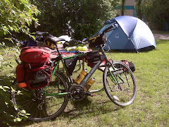
We are camping at the Gas City Campground in Medicine Hat. Yes we are actually camping tonight! Just about forgot how to set up the tent! This is a nice little campground on the top of a hill and it has trees...something we have not seen in a while. It also has a picnic shelter and laundry facilities in case anyone else is ever adventurous enough (or maybe dumb enough) to try what we are doing. When we arrived we were told that we are about the 8th group of individuals who have been through so far attempting the cross country trip. One was on a moped (smart guy) and another was roller blading across Canada. Maybe that could be my next adventure...I used to know how to skate...Sue says maybe with my next wife!!!

Daily Distance = 62.00km. Time on the bikes = 3 hours 6 minutes. Average Speed = 19.93km. Maximum Speed = 52.42 km on the flats. Wildlife Sightings = Deer, Avocets, Horned Larks, Shovellers by the dozen.

Kevin = 3 Sue = 0.

Saturday, May 29, 2010

Learning to Dance in the Snow....

Saturday, May 29

Bow Island to Bow Island

An unexpected snowfall has us 'hunkered down' in our hotel for an 'unplanned' day off. A nasty surprise! Looking out the window this morning I did a 'double take'! Was it really possible that the ground was white? Then the sound of a snowplow going by on the Hwy confirmed that I was not hallucinating! We had a significant amount of snow on the ground, it was snowing extremely hard, and the temperature was -1. Thank goodness the weather was lousy yesterday so we were 'holed up' in a hotel and not in our tent!!! By noon the snow was starting to melt and by 2:00 it has changed over to rain. Still not nice out. Our scheduled ride to Medicine Hat has been delayed for a day. We are catching up on the local news. We have read the Medicine Hat News and The 40-Mile County Commentator and Sue has just found an advertisement to an all-inclusive trip to Puerto Vallarta for $498...maybe we could ship the bikes home and fly to the sunny south...Calgary Airport is not that far! We are planning our own 'Stanley Cup Party' for tonight. Life is not all that bad!!!

Daily Distance = for the first time on this adventure the bicycles have not moved.

Kevin = 3 Sue = 0.

Agriculture and Ducks....

Friday, May 28

Taber to Bow Island

On the road by 8:10 to a 'drizzly and cold' start. Compared to yesterday it was a beautiful day! With the wind in the Northwest cycling was much easier than the past 2 days.

Yesterday we had been pondering what crops were grown in the area and today we discovered that the two major crops are sugar beets (Rogers Sugar) and potatoes, both grown in a 'huge' way. The last couple of days John Deere was dominant but through this area Case-IH is 'King'. Everything is irrigated here and we passed through the small town of Burdett which has a claim to fame that it had the 1st 'irrigation pivot' in Canada. This spring and particularly today, the irrigation systems were sitting under water. All the locals are complaining that they are really late getting their crops in and we saw guys actually pumping water 'from' their fields rather than 'on to' them. We had Southern Alberta pegged as ranch land but here the dirt farmer is dominant.

At 11:00 we stopped for our second breakfast in Grassy Lake at the 'Dew Drop In', a Mexican Mennonite Restaurant. The breakfast was a Mexican version of bacon and eggs. Burritos, salsa, and beans served with your breakfast and 'oh so good'! It appears like the area has a large Mexican Mennonite population as we passed a large Mennonite school. (And by the way, what is with these names...Grassy Lake with not a lake in sight...Bow Island...don't you have to have bodies of water to have an island)?

As we cycled today we stopped numerous times to see ducks in the ditches and fields. It was fun to be able to take the time to 'stop and smell the roses'!!!

We are staying in the Bow Island Lodge (the only lake is in the parking lot). In 1905 natural gas was discovered here, the first in Alberta, and for years this supplied Lethbridge and Calgary. Production stopped in 1996.

Daily Distance = 63.84 km. Time on the bikes = 4 hours 8 minutes. Average Speed = 15.41 km. Maximum Speed = 32.26 km. Present temperature = 4 degrees and pouring rain with a forecast low for the start of the ride tomorrow 1 degree and raining. Wildlife Sightings = Red Winged Blackbirds, Yellow Headed Blackbird, Eastern Kingbird, Blue Winged Teal, Cinnamon Teal, Red Headed Duck, Coots, Gadwall, Shovellers by the dozen.

Kevin = 3 Sue = 0.

Thursday, May 27, 2010

Learning to Dance in the Rain....

Thursday, May 27

Lethbridge to Taber

On the road by 8:10 with 'all' of our rain gear on. 7 degrees and raining hard as we made our way out of 'cycling unfriendly' Lethbridge. It is difficult to enjoy the scenery under such circumstances. It appears that the Taber area is mostly cropland. Alfalfa, wheat, potatoes were visible to us through the haze. We passed by a very large McCain's plant but are unsure what is being produced there. (Sorry Mary Lou)! Taber is also the sweetcorn capital of Canada and is the headquarters of Frito-Lay Canada. One wonders if a lot of potatoes are grown here?

It was kind of ironic that everything is irrigated in this area. 375 km long irrigation canal and today all the farmland was flooded. That could well be because of the 50 mm of rainfall overnight and the 75 mm that fell today and by the time this storm clears out. (Hopefully by tomorrow morning)!!!

Many things were tested today: our rain gear, our layering of clothing, our abilities to ride in 40km winds, and certainly our ability to persevere. It really was hard to stay positive and yet while stopped for 'hot chocolate' a couple of times we were inspired by the local people's interest in what we were trying to accomplish. (Maybe they all just thought we were nuts, who knows)!!!

We are staying at the Heritage Inn. Again not camping, but as we entered Taber looking like 'drowned rats' in the 'pouring' 4 degree weather, we felt a warm dry room might be prudent. Southern Alberta weather is certainly not hospitable.

Daily Distance = 54.00 km in the pouring rain. Time on the bikes = a wet 4 hours 40 minutes. Average Speed = a blistering 11.52 km. Maximum Speed = 20.35 km. Wildlife Sightings = wildlife are not dumb enough to be out in weather like this except for the Shovellers.

Kevin = 3 Sue = 0.

"Life isn't about waiting for the storm to pass...it's about learning to dance in the rain".

Wednesday, May 26, 2010

Which Way Are The Prevailing Winds Supposed to Blow????

Wednesday, May 26

Fort Macleod to Lethbridge

On the road by 7:10 to a darkening sky. Today was dominated by ranch land on one side of the highway and cropland on the other side. Big John Deere tractors dominated the landscape and I mean 'big' ones. First 10km went by easily and then we found out what 'Prairie Winds' are all about. For the next 45 km we fought strong head winds. (Whatever happened to my pledge that the winds would always be in our backs)? Are the prevailing winds in Canada not supposed to blow from the west? Well, not today! The winds were strong enough that the 'Granny Gear' was dominant again today. Slow going and hard work. To add insult to injury it is a gradual climb from Fort Macleod to Lethbridge.

We had heard about the Lethbridge Hill from some people yesterday. The Lethbridge Hill is a huge gully where the highway plunges down into the Oldman River Valley and then begins to climb for almost 5 km out of it. Throw in lanes merging on and off and you have a nightmare for bicyclists! Hwy 3 through this area is anything 'but' bicycle friendly. The shoulders at times disappeared and their was an awful lot of traffic...definitely too much for cycling.

Our goal today was to have got well past Lethbridge. By the time we had fought the winds, climbed up into Lethbridge and got rained on, we were 'toast'.

We are staying at the Pepper Tree Inn. I know another Motel...but by the time we arrived it was starting to rain. The weather forecast for tonight and tomorrow (come to think of it for the next 3 days) leaves a whole lot to be desired. Up to 40mm of rain is predicted. We plan on riding anyway! At least our gear will start off dry.

Daily Distance = 55.16 km. Time on the bikes = 4 hours 30 minutes. Average Speed = 12.28 km. Maximum Speed = 33.07 km. Wildlife Sightings = Shovellers, Blue Winged Teal.

Kevin = 2 Sue = 0.

Tuesday, May 25, 2010

Big Sky....

Tuesday, May 25

Blairmore to Fort Macleod

A very cold night last night as it was -2 as we got up. Rather 'chilly' in the tent! 0 degrees when we began to ride at 7:40. Today was a transition day. We left the mountains behind. Again a little bit sad to see the mountains gradually disappear. However, Alberta brings a whole new set of experiences. Day 1 conclusions: Alberta is all about 'big'. Big pickup trucks, big shoulders on the roads, big wind turbine developments, big ranches, and 'big sky'. After riding for 34 km we stopped at the Mill View Restaurant (not a mill in sight) for our second breakfast. The restaurant had some locals in it , one gentleman being a rancher who had spent the weekend branding calves. Even the 'Big Breakfast' that I ordered lived up to everything being big. 3 pieces of ham, 3 pieces of bacon, 3 sausages, 2 eggs, hash browns and toast. What a great breakfast for touring cyclists!!!

Today we saw a huge yard (feed lot) full of horses. Conservative estimate would be a 1000. We think it was a horse auction business. They were feeding them just like a cattle feed lot.

The foothills of the Rockies are a quite a change for us. Finally some 'flat' riding. Our fear of bad winds never materialized today. The Pincher Creek area has a huge number of wind turbines, the first in Canada (1983). The wind most days blows up to 80 km. We lucked out at least for today! The ride was really good.

We are staying at the Red Coat Inn Motel in Fort Macleod partly because the campgrounds are about 5 km outside of town and not in our direction and partly because we screwed up. (We actually missed the fact that most of the campgrounds were on Hwy 2 towards Calgary until we were well past the turnoff).

Daily Distance = 94.75 km. Time on the bikes = 5 hours 18 minutes. Average Speed = 17.84 km. Maximum Speed = 46.24 km. Wildlife Sightings = Magpie, Western Meadowlark, Coots, Red Headed Duck, Yellow Headed Blackbird, Kestrel.

Kevin = 2 Sue = 0.

Monday, May 24, 2010

British Columbia Reflections....

Today was a day off to do chores, regenerate, do some 'tourist' stuff, and reflect upon what we experienced in BC.

Top 3 things we liked about BC: #1 Scenery, #2 Scenery, #3 Scenery!!! What more can be said. Trying to list the highlights is almost impossible. Each day brought a new experience. Manning Park, though extremely difficult to ride through, was one of the #1 highlights. The Lower Okanagan, Keremeos and Osoyoos sitting in Canada's only desert, ranks high. The numerous river valleys with their ranch land and mountain vistas can only be seen to be appreciated. Then the majestic Rockies (that everyone believes are the only mountains in BC...do we have 'news' for you) have their rock face tops towering over everything. Scenery, scenery, and more scenery!!!

If their is a downside to our experience it was that the provincial park campgrounds have no services a must for touring cyclists!

Riding in BC is difficult but quite nice. Obviously the BC government understands that paving the shoulders of their roads, in the long term, saves money and lives. BC actually promotes cycling on their highways. What is wrong with Ontario? The drivers seem to be much more courteous to bikes and even 'big rigs' give you lots of space. On a scale of 1 to 10; BC drivers rate a 9+.

The people we have met have been extremely friendly and seem to understand what tourism dollars are all about. Highway #3, the Crowsnest Highway, has rest stops every 50 to 70 km. Ontario over the last 25 years has removed all of theirs! BC has been a pleasure to visit and cycle across!

Today we visited the Frank Slide Interpretive Centre. In 1903 the small mining town of Frank was hit by a rock slide when the side of Turtle Mountain let go. 90 people were killed under the rubble. The town was rebuilt and coal was mined until 1960. Well worth the visit!

Daily Distance = 18.50 km. Time on the bikes = 1 hour 26 minutes. Average Speed = 12.66 km. Maximum Speed = 34.21 km. Wildlife Sightings = Red Breasted Nuthatch.

Kevin = 2 Sue = 0.

Goodbye British Columbia...Hello Alberta....

Sunday, May 23

Fernie to Blairmore, Alberta

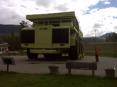
On the road by 8:10. Fernie was a typical ski town. Not that much happening now that ski season is over. Our ride was nice to Sparwood where we had our obligatory picture taking with the 'largest truck in the world'. Sparwood is a mining town and has been since the late 1800's. The big truck was used for a period of time to move earth to get at the coal. Coal mining has certainly changed in the last 100 years. It has gone from digging tunnels and coal by hand to the style today where they cut off the top of the mountains, take the coal out, and rebuild the top of the mountain with slag. Obviously quite a few mine sites still operating.

After Sparwood we did a gradual climb to the Crowsnest Pass aided by a 'tail wind'. Again some stunning views! The wind that I said I wanted the whole trip was sure a pleasure today. (I guess one tail wind in 2 weeks + is not bad!). It literally blew us from the Crowsnest Pass all the way to Blairmore!

The feeling when we passed from BC to Alberta is hard to describe; elation, relief, disappointment, a sense of accomplishment. Take your pick. They all apply! One province down...nine more to go!!!
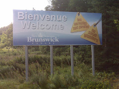
We are staying at the Lost Lemon Campground and RV Park in Blairmore, Alberta (can't get over that we have left BC behind except for the memories). We are going to take tomorrow off as we want to visit the Frank Slide and maybe the Bellevue Underground Mine.

Daily Distance=73.61 km. Time on bikes=5 hours 8 minutes. Average speed=14.33 km. Maximun speed=59.34 km.

Wildlife sightings=deer, elk, red tailed hawk, bald eagle.

Kevin=2 Sue=0

Sunday, May 23, 2010

Mountain Views, Valley Views...Pictures Can Never Tell the Story....

Saturday, May 22

Cranbrook to Fernie

Last night was the coldest of our trip. The tent fly and grass were white with frost. The water bottles were "slushy" to try to make coffee with. Tested our "layering" of clothes.

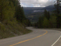
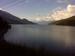
On the road by 7:40 and all bundled up. Today was all about views. The mountain peaks were never ending. Our necks were getting sore from "gawking". Then we came upon one of the most beautiful river valleys imaginable. The Kootenay River with its green, lush, cattle grazing land was spectacular. Around every curve another vista. Wow!!!
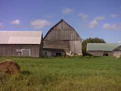
And oh yes, there was that thing called riding. We had a major accomplishment today. We rode over "100 km" for the first time in our lives and we did it in the Rockies! Not an easy ride but certainly not our toughest.
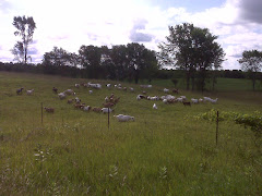
Today we met a young guy who was riding his bike from Calgary to the Okanogan. He is hoping to find work in the vegetable and fruit industry. Personable young guy. Good luck to him.

We are staying in the Snow Valley Motel and RV Park. It has a hot tub for our weary legs.

Daily Distance = 101.19 km. Time on the bikes = 6 hours 33 minutes. Average Speed = 15.38 km. Maximum Speed = 42.14 km. Wildlife Sightings = Green Winged Teal, Ruddy Duck.

Kevin = 2 Sue = 0.